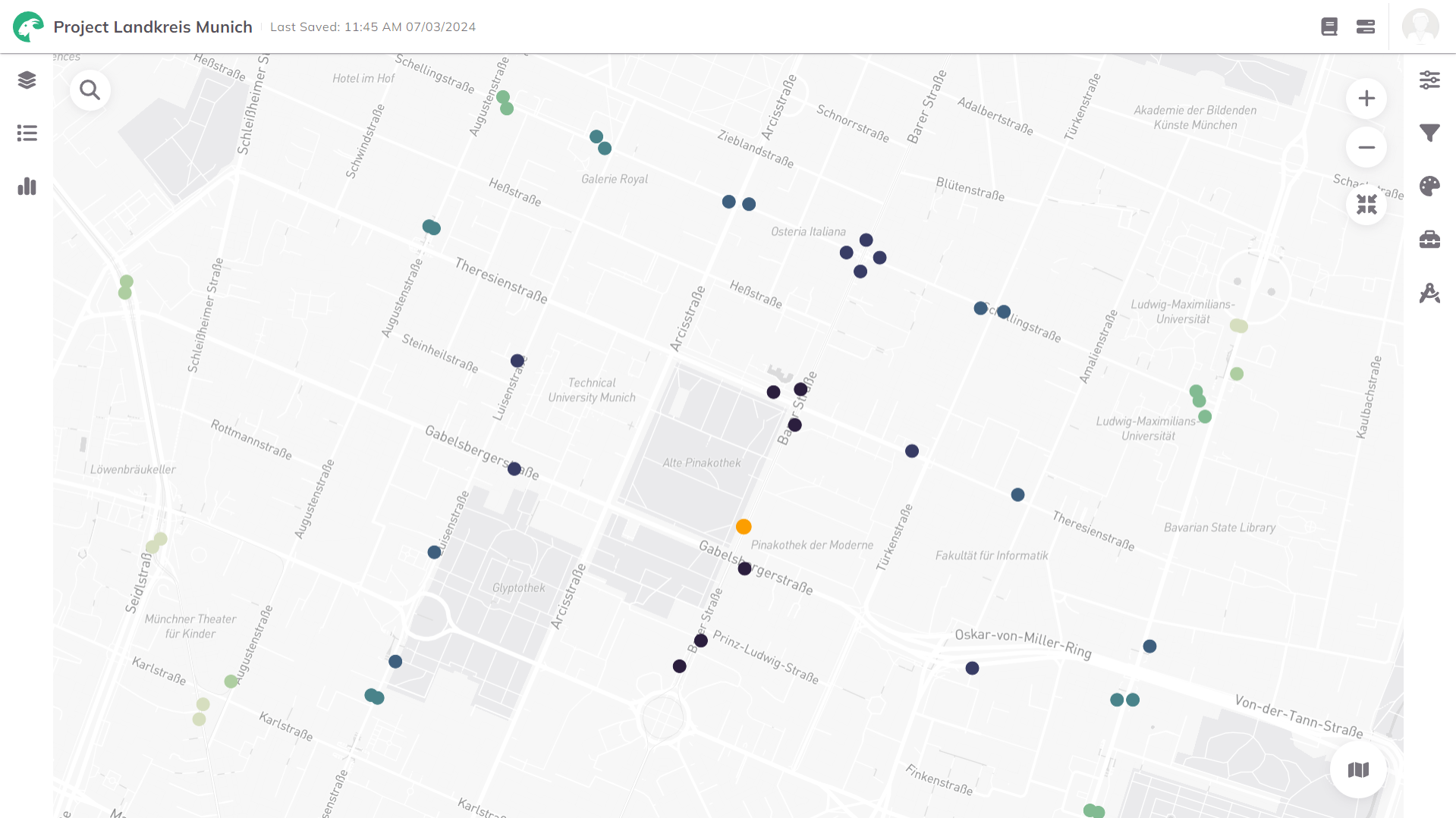
PT Nearby Stations
The PT Nearby Stations analysis is used to find public transport stops accessible by walking or cycling within a given time. For each stop, departure information by mode and route is provided.
1. Explanation
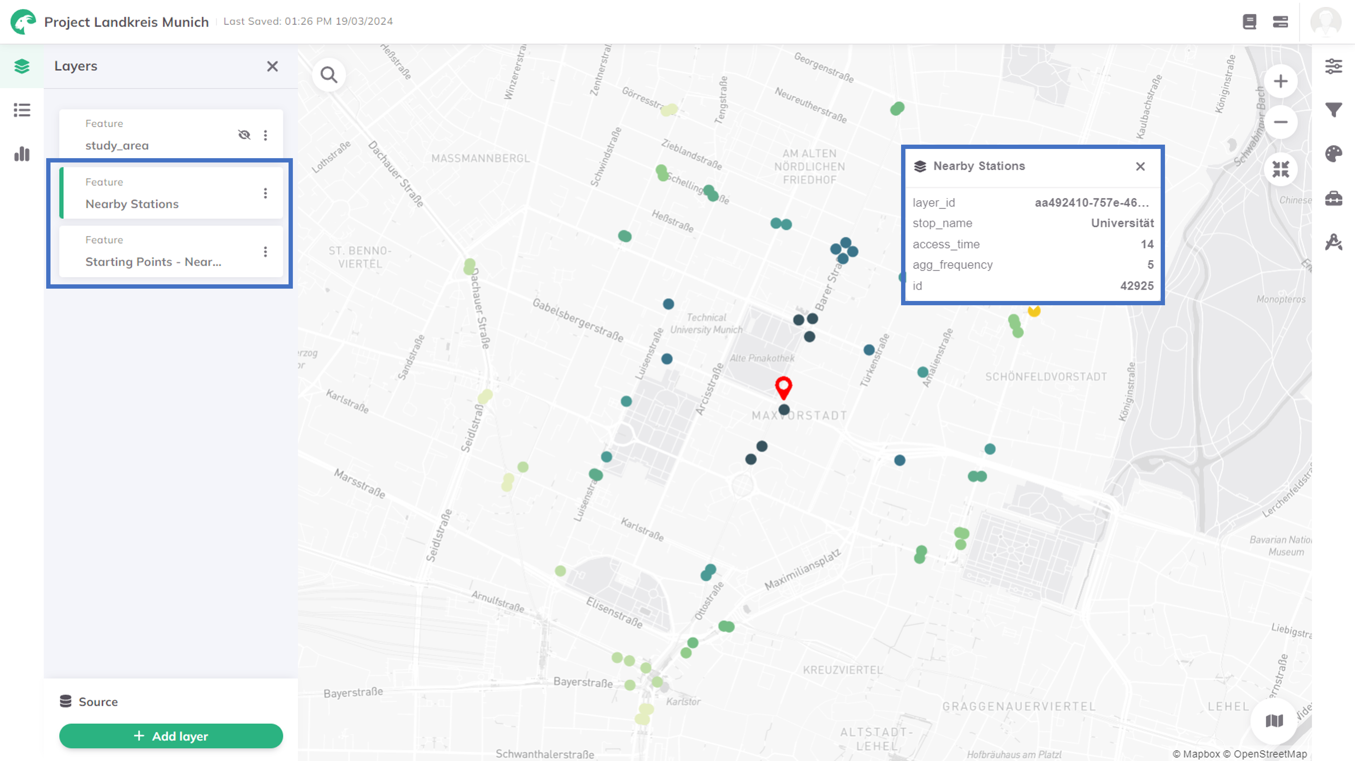
The Public Transport (PT) Nearby Stations access analysis is a suitable tool to visualize public transport stops and their connections that are accessible by walking/cycling from one or more starting point(s). The nearest stops, the public transport lines available there, their frequency, and the journey time to reach the stop on foot and by bike are provided as a result.
Proximity to nearby stations is essential for various aspects of urban life and is important in urban planning. The availability of public transport connections significantly improves accessibility for residents, workers, and visitors.

The calculation of the nearby stations is only available for areas where the public transport network is integrated into GOAT.
In case you need to perform analysis beyond this geofence, feel free to contact the Support and we will check what is possible.
2. Example use cases
- Which public transport stations are nearby and provide convenient access to key attractions and landmarks for tourists exploring a new city?
- When considering daily commuting to work, which nearby public transport stations offer optimal routes and schedules for a seamless journey?
- What are the nearby public transport stations for convenient access to shopping centers?
3. How to use the indicator?
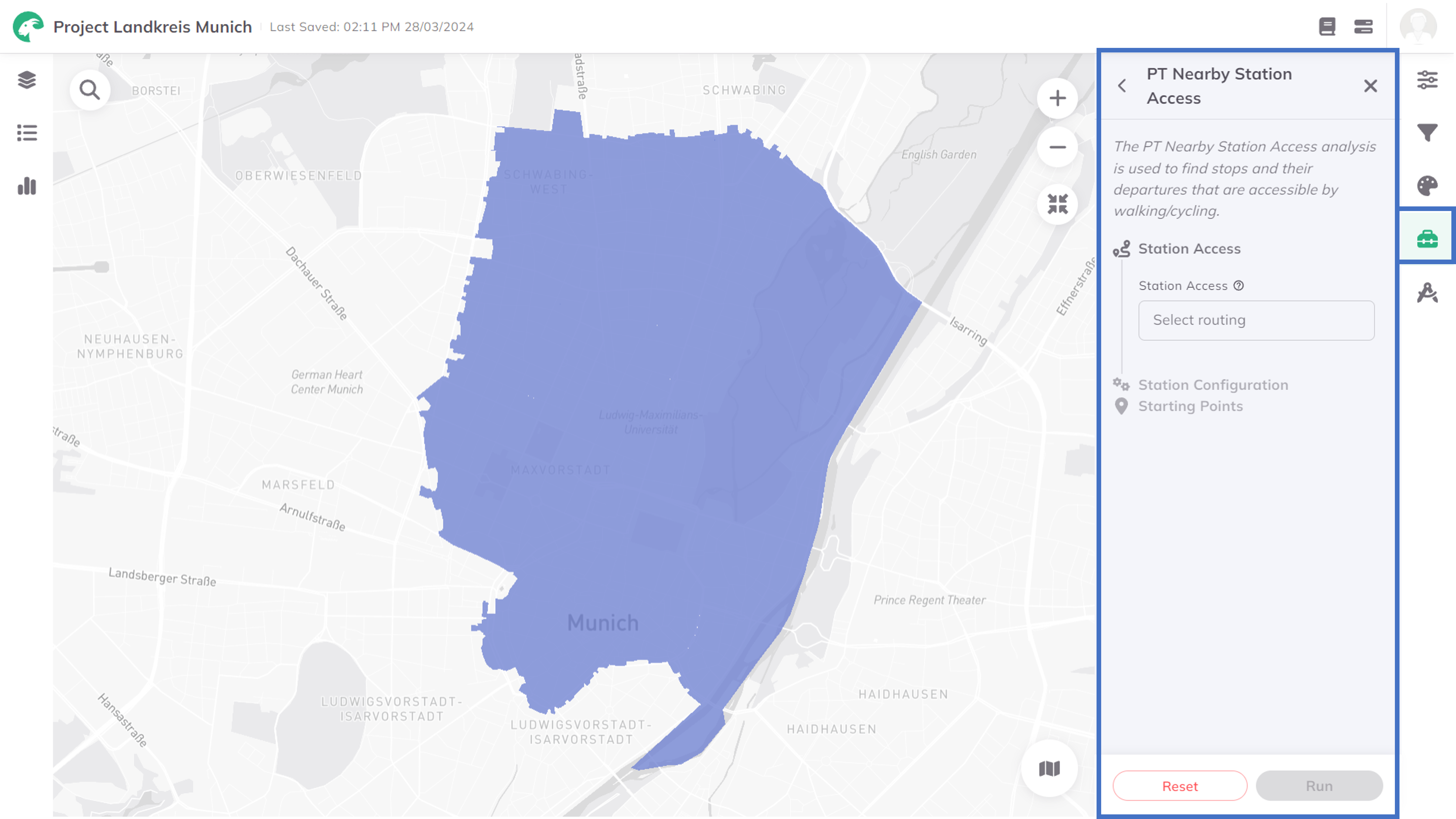
Toolbox Accessibility Indicators menu, click on PT Nearby Stations.
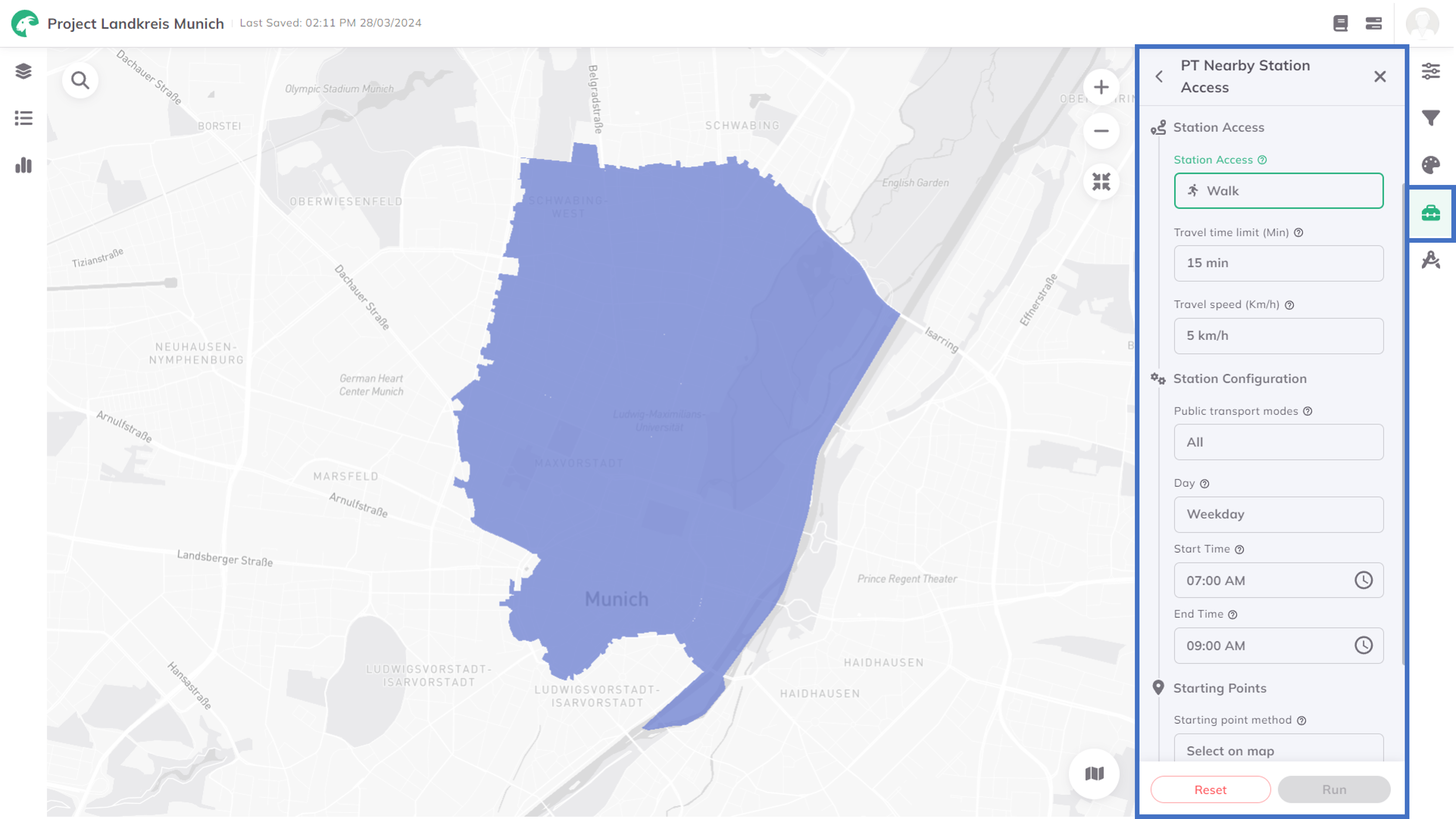
Station Access
Station Access mode (walk, bicycle, or pedelec), which shall be used for the way to the PT station.Travel time limit (min) and Travel speed (km/h).Station Configuration
Public transport modes shall be considered for the nearby stations.Day, Start Time and End Time you would like to see the public transport connections.
Starting Points
Starting point method to define how you like to define the starting point(s) for the trip(s). You can either Select on map or Select from layer.- Select on map
- Select from layer
Select on map. Select the starting point(s) by clicking on the respective location(s) in the map. You can add as many starting points as you like.Select from layer. Select the Point layer which contains the starting point(s) you would like to use.Run. This starts the capturing of the Nearby Stations from the selected starting point(s).Depending on the number of the selected starting points, the calculation might take some minutes. The status bar shows the current progress.
Results

Want to style your results and create nice-looking maps? See Styling.
4. Technical details
Similar to the Public Transport Quality Classes (German: ÖV-Güteklassen), this indicator is calculated based on GTFS data (see Inbuilt Datasets). Based on the selected modes, day, and time window, the PT Nearby Stations are received.