Scenarios
Scenarios let you test "what-if" situations by modifying existing layers or creating new features. Add, edit, or delete points, lines, and polygons, then run accessibility indicators to analyze how these changes impact accessibility—all without altering your original data.
You can also modify the Street Network - Edges base layer, which represents the road network and affects routing calculations.
Only geographical layers can be modified in scenarios. Tables and rasters cannot be edited. You can learn more about data types.
1. How to create and edit scenarios?
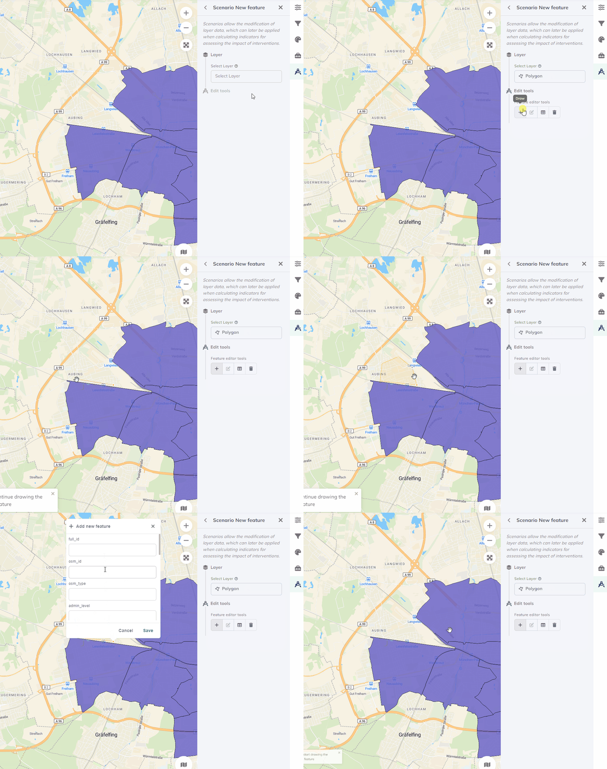
Scenarios Create scenario and name your scenario.More Options Edit.Select layer, then pick from Edit tools: draw modify delete - Draw
- Modify
- Delete
Point: Click on the map where you want to add a point. Fill in attributes if required, then clickSave. New features appear in blue.Line: Click to start drawing, continue clicking to shape the line, double-click to finish. Fill in attributes if required, then clickSave. New features appear in blue.Polygon: Click to start drawing, continue clicking for each corner, click the starting point to complete. Fill in attributes if required, then clickSave. New features appear in blue.
- Click a feature to select it, edit its attributes, then click
Save. Modified features appear in yellow.
- Click the feature you want to remove, then click
Delete. Deleted features appear in red.

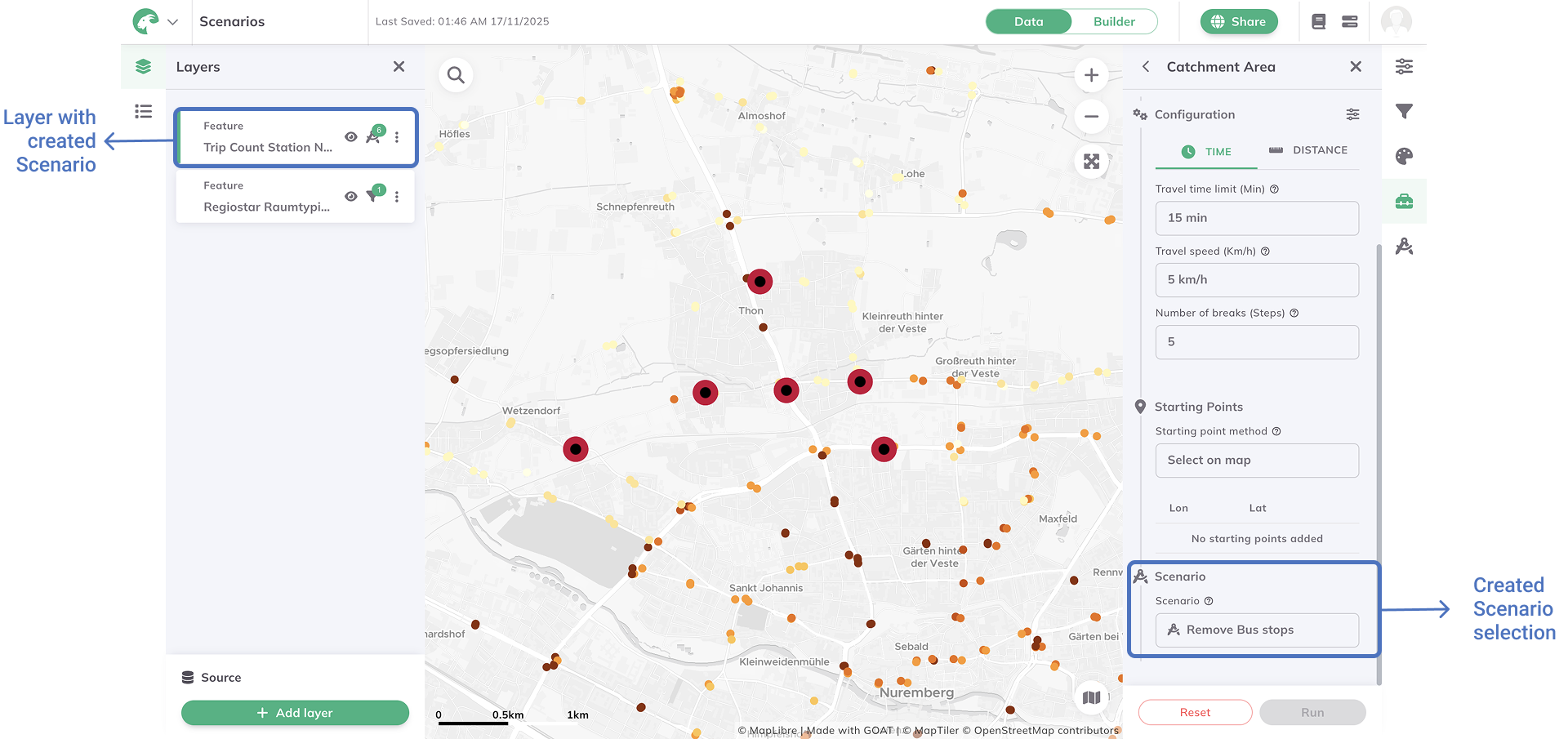
Toolbox and select an indicator.scenario from the dropdown to analyze your changes.
2. Managing scenarios
Create multiple scenarios to test different configurations:
- Select: Click a scenario to view its changes
- Modify: Use the options menu
to rename, delete, or edit
- Track changes: Modified layers show
with a number
- Deselect: Click the active scenario again to return to the original map
3. Street Network - Edges
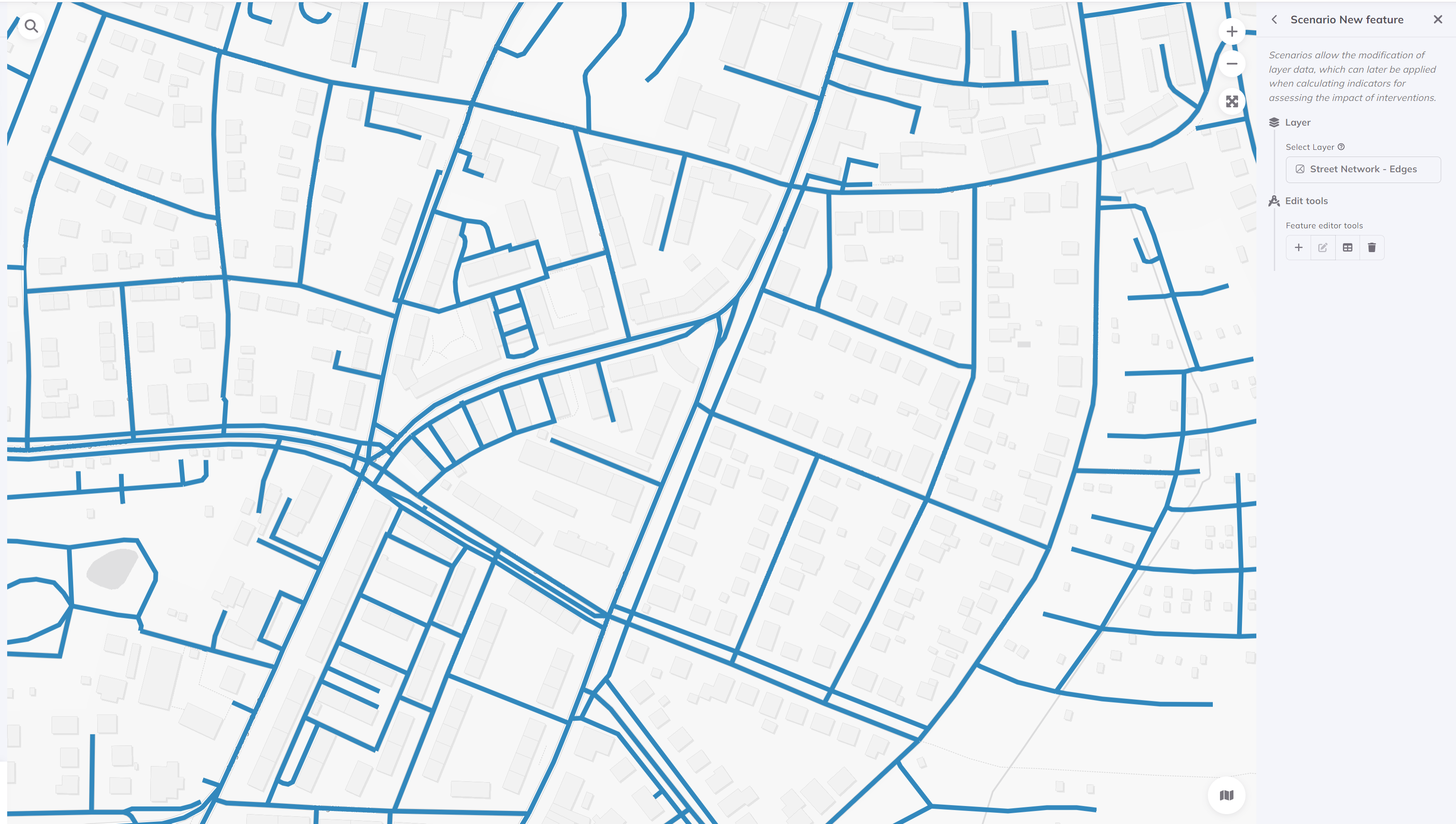
Street Network - Edges is a base layer representing the road network available in all projects. You can only see this layer when editing scenarios at high zoom levels.
Use Scenarios to modify street lines—add new roads, close existing ones, or change road properties.

Street Network changes only affect Catchment Area calculations. Other indicators use the original network.