Dataset Types
On GOAT, you can work with datasets from Plan4Better’s catalog, upload your own, or connect to an external service by URL (WFS, WMS, WMTS, XYZ Tiles or COG). It accepts various formats for both Feature Datasets and Raster DatasetsGlossaryRaster dataSpatial data stored as a grid of cells, each holding a value. Suited to continuous things like temperature, elevation or land cover.Read more ↗, as well as Street Networks and Public Transport Networks. Here we explain the different types of datasets you can use in GOAT.
Feature Datasets
1.1 Spatial Features
Feature datasets store spatial features like points, lines, or polygons. On GOAT you can upload data from Shapefiles, Geopackages, GeoJSON, KML, ZIP, or Parquet files, or add a WFS external URL. For raster external sources (WMS, WMTS, XYZ Tiles, COG), see Raster Datasets below. You can visualize, style, and analyze these datasets using the different tools from the toolbox.
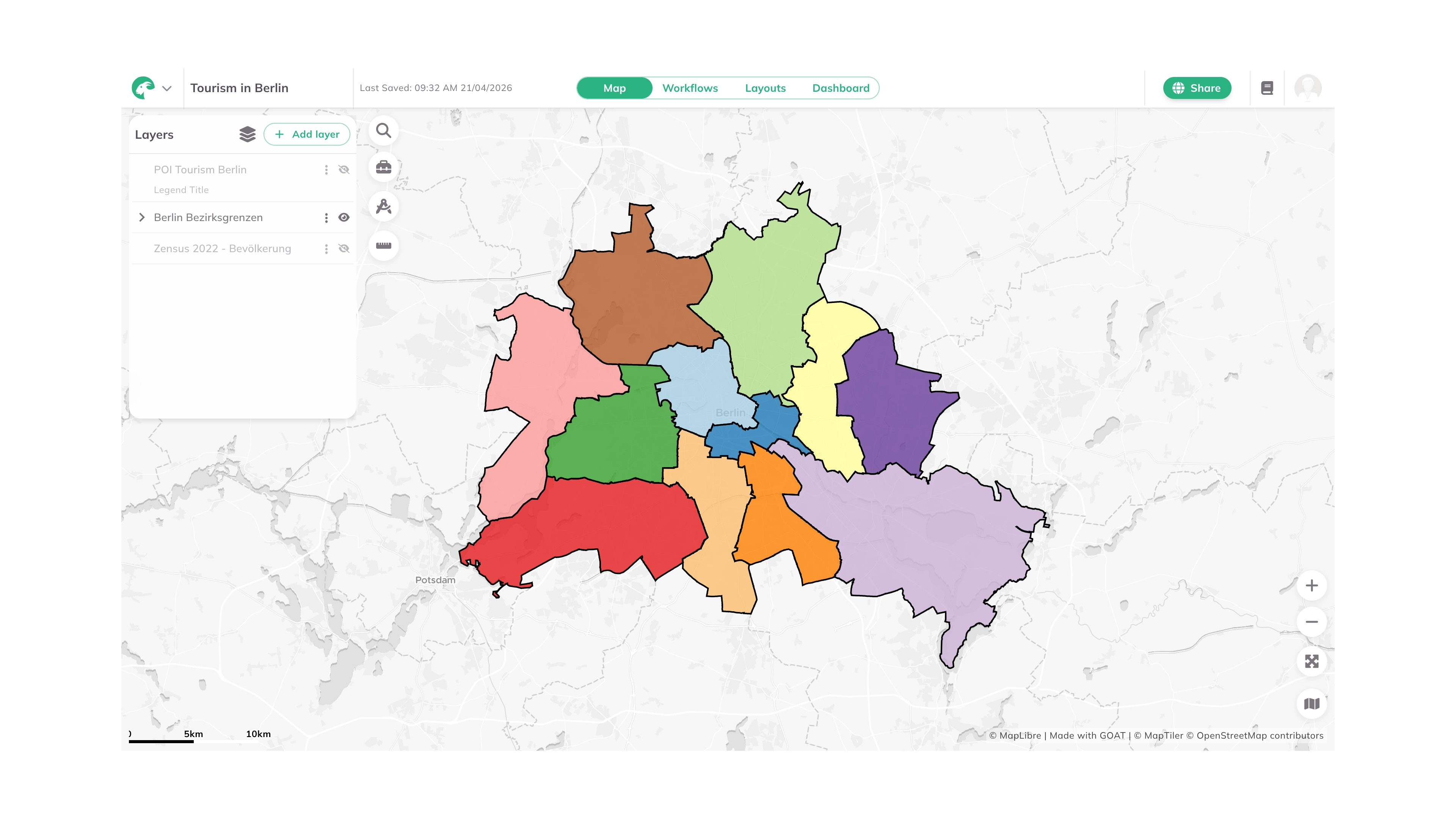
Example of spatial features displayed in GOAT
GOAT recognizes two types of feature datasets based on their source:
-
Feature Dataset Standard: These are the datasets you upload yourself (like GeoJSON, GPKG, KML, and ZIP files), including the layers that arrive with a Street Network or a Public Transport Network. Think of these as your "raw materials" - the original data you bring into GOAT to work with.
-
Feature Dataset Tool: These are datasets created by GOAT's analysis tools. When you run an analysis (like creating catchment areasGlossaryCatchment areaThe area that can be reached from a point within a given travel time or distance, following the real network rather than a straight line.Read more ↗ or heatmapsGlossaryHeatmapA map that shows a computed value across a continuous surface using colour, rather than symbols at individual locations.Read more ↗), the results become this type of dataset.
1.2 Non-Spatial Datasets
Tables are non-spatial datasets without geographic reference points, so they can't be visualized on the map. Import them in CSV or XLSX formats for analysis and data management.
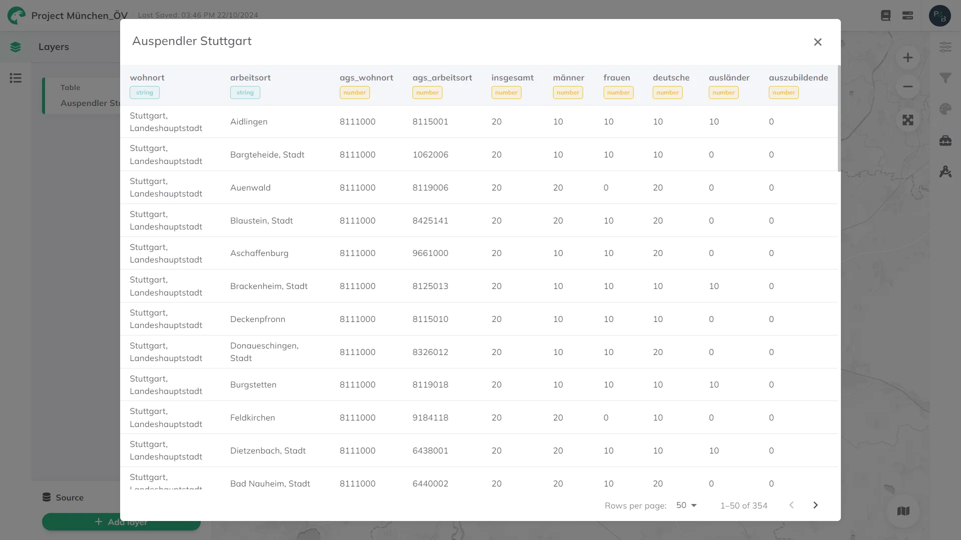
Example of a table displayed in GOAT
Street Networks
A Street Network is a routable representation of roads, paths and cycleways. GOAT provides a built-in network, and you can import your own whenever you want routingGlossaryRoutingCalculating the best path between places across a transport network, and the time or distance that path takes.Read more ↗ to run on data you control: a network you maintain yourself, or a planned one you want to test before it is built.
Your data must follow the OvertureGlossaryOverture MapsAn open map dataset of roads, buildings, places, addresses and boundaries, released monthly in one schema by the Overture Maps Foundation.Read more ↗ format, segments and connectors as Parquet files, packed into a .zip whose name contains overture, for example overture.zip or berlin_overture.zip. Other street data, including OpenStreetMap, is not supported at the moment.
A street network is made up of two layers that GOAT keeps together:
- Edges: the routable segments. This is the layer you edit when you change the network.
- Nodes: the points where edges meet. GOAT maintains these for you whenever you save an edge, so the network stays routable.
Street networks power GOAT's Walking, Cycling, E-bike, and Car routing. To import one, see Adding content; for what GOAT's built-in network contains and how to bring your own, see Network Datasets.
Public Transport Networks
A Public Transport Network describes the stops, lines and timetables of a transit system. GOAT provides a built-in network, and you can import your own whenever you want to analyse a service you control: your own feed, or a timetable you are planning.
Your data must follow the GTFSGlossaryGTFSAn open standard for publishing public transport timetables, stops and routes as a set of text files, so any software can read the same data.Read more ↗ format, packed into a .zip whose name contains gtfs, for example gtfs.zip or vbb_gtfs.zip. The .zip can be at most 200 MiB: GOAT builds the timetable from the whole feed at once, so larger feeds cannot be imported.
The member layers follow the GTFS feed itself: Stops, Routes, Trips and Stop times are always present, and Agency, Calendar and Shapes are added when the feed provides them.
GOAT connects stops to streets so that it can route the walk to and from a stop. You therefore choose a Street Network while uploading the GTFS file, either GOAT's built-in Default (Europe) network or one of your own, which then has to be imported first.
Public transport networks power GOAT's Public Transport routing. To import one, see Adding content; for what GOAT's built-in network contains and how to bring your own, see Network Datasets.
Datasets made of several layers
Street Networks and Public Transport Networks are both made up of several layers that only make sense together. GOAT calls such a dataset a bundle and manages it as a unit: its layers are shared together, they appear together in a project, and deleting the dataset removes all of them.
You will meet the term while working: the upload dialog confirms that a recognized file will be imported as a bundle, the Catalog labels an entry holding several layers Bundle, and sharing or deleting one always applies to the whole set.
Rasters Datasets
Raster datasets can be uploaded directly as COG (Cloud Optimized GeoTIFF) files, or connected from external sources via WMS (Web Map Service), WMTS (Web Map Tile Service), XYZ Tiles, or a direct COG URL (.tif/.tiff link). They provide georeferenced map images, such as topographic maps, but on GOAT they’re static, so they don’t support analysis or editing.
Raster styling depends on the external service (e.g., GeoServer). You can’t change the color scheme or feature representation in GOAT.
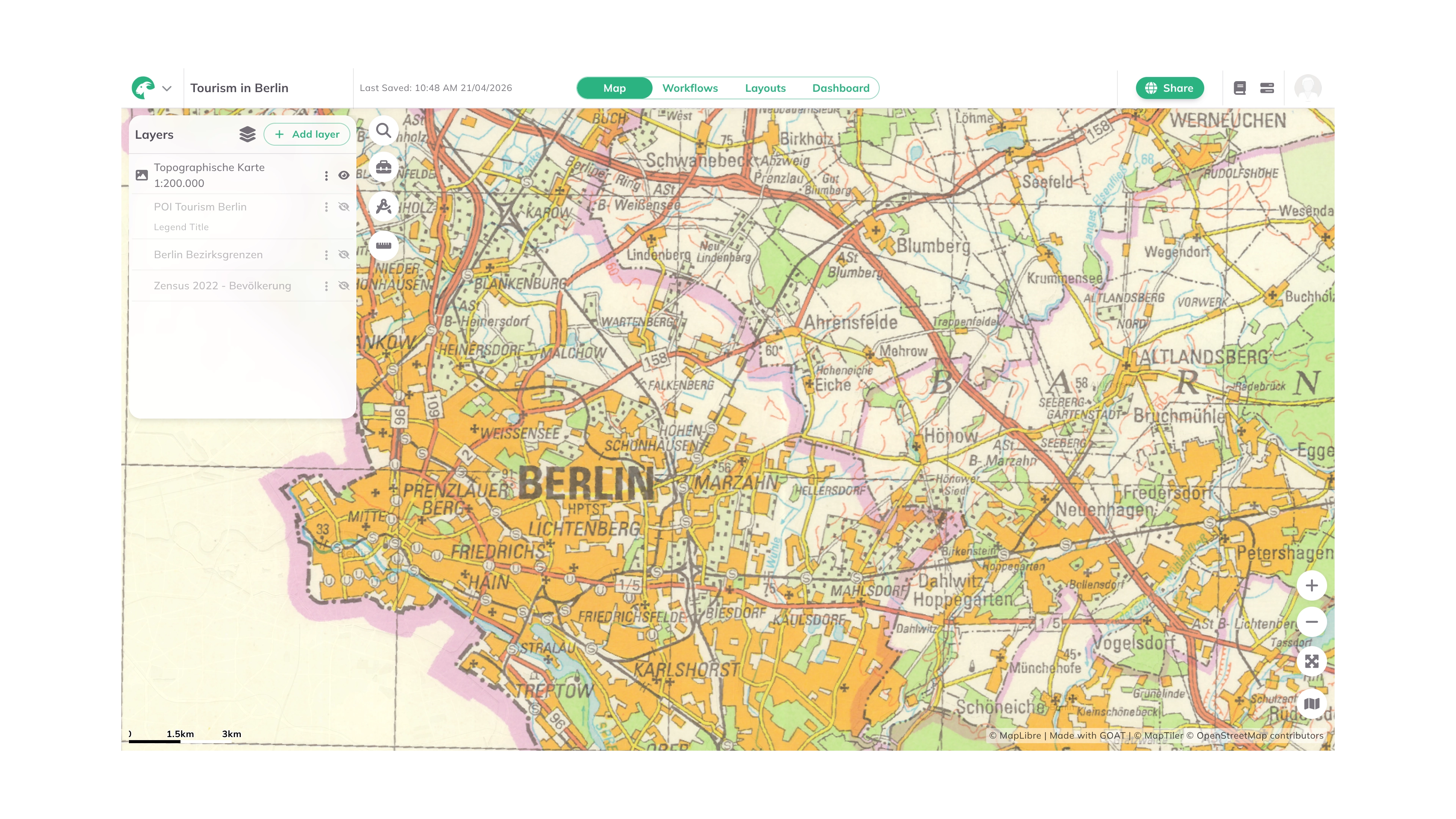
Example of a raster layer displayed in GOAT
-
WMS (Web Map Service): Supports zooming and panning, ideal for basemaps, but outputs static images and loads slower.
-
WMTS (Web Map Tile Service): Uses pre-rendered tiles for fast loading and smooth zooming. Best for large areas and consistent map styles.
-
XYZ Tiles: Offers fast zooming and panning with tiles defined by X (longitude), Y (latitude), and Z (zoom level) coordinates. Ideal for fast-loading maps with consistent performance at different zoom levels.
| WMS | WMTS and XYZ Tiles | |
|---|---|---|
| Type of URL in GOAT | Capabilities URL | Capabilities (only WMTS), Direct URL |
| Data output | Dynamic map images | Pre-rendered, cached map tiles |
| Structure | No tiles - images generated on-the-fly | Structured tiles based on grid |
| Performance | Slower (images generated per request) | Faster (tiles cached) |
| Customization | Limited | Limited |
| Scalability | Less scalable | Highly scalable |
| Zoom level | Variable, set by request parameters | Fixed zoom level, predetermined by server |