Public Transport
The Public Transport Routing in GOAT is essential for performing analyses that include public transport trips.
1. Objectives
Public transport routingGlossaryRoutingCalculating the best path between places across a transport network, and the time or distance that path takes.Read more ↗ facilitates intermodal analysis by integrating access and egress modes, such as walking, cycling, or driving to and from the station. This is more complex than the other routing modes as it requires the merging of different datasets (such as sidewalks & bike lanes, public transport stops & schedules, etc.) and calculation approaches.
Public transport routing is used for indicators such as Catchment Areas and Heatmaps in GOAT.
2. Data
Transit Data
Utilizes data in the GTFS (General Transit Feed Specification) format for static public transport network information (stops, routes, schedules, transfers, and more).
Street Data
Incorporates street-level information from OpenStreetMap to support multi-modal routing and real-world path connections (includes sidewalks, bike lanes, and crosswalks).
3. Technical Details
A public transport trip consists of three legs: an access leg from the origin to a PT station, the transit leg through the PT network, and an egress leg from the PT station to the destination. The access and egress modes can be configured independently.
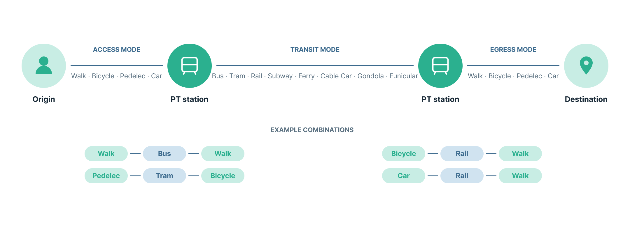
Public transport routing is performed by GOAT's own high-performance routing engine, which wraps the open-source nigiri library. Nigiri is a C++ library from the MOTIS project that provides one-to-all public transport connection search using the RAPTOR algorithm.
The transit leg is computed by nigiri, while the access and egress legs (first and last mile) use GOAT's own Dijkstra implementation, the same routing used for active mobilityGlossaryActive mobilityGetting around under your own power, mainly walking and cycling, including pedelecs, wheelchairs and scooters.Read more ↗ and car. This keeps street-level routing consistent across all transport modes.
Routing Options
Modes
Analyses for the following modes of public transport are currently supported by GOAT. Choose between one or more, keeping in mind that some modes may not be available in all regions.
bus tram rail subway ferry cable_car gondola funicular
Travel time limit
The maximum journey duration to consider for public transport routing. A maxium of 90 min is currently supported. This includes the time spent during access and egress from public transport stations.
Day
The day of the week to consider for public transport routing. Choose between Weekday, Saturday and Sunday. This is useful for evaluating changes in service between weekdays and weekends.
Start and End time
A time window for public transport routing. The engine evaluates every departure minute within this window and keeps the fastest journey to each reachable location. It is not an average over the window. The result is therefore the best-case, largest possible catchment areaGlossaryCatchment areaThe area that can be reached from a point within a given travel time or distance, following the real network rather than a straight line.Read more ↗ from your specified origin point. A journey is considered to fall within the time window solely based on its start time, regardless of its end time or duration.
Certain indicators may only support a single departure or arrival time instead of a time window. In this case, the engine will only evaluate journeys that start at or after a departure time or end at or before an arrival time.
Maximum transfers
The maximum number of transfers a PT journey may include. A maximum of 5 transfers is supported.
Access and Egress
The access leg (origin to public transport stop) and the egress leg (public transport stop to destination) can be configured independently. For each, the following options are currently supported.
| Tool | Mode | Calculate by | Limit |
|---|---|---|---|
| Catchment Area | Walk, Bicycle, Pedelec, Car | Time or Distance | Upto overall Limit |
| Heatmaps | Walk | Time | 30 minutes |
| Huff Model | Walk | Time | 30 minutes |
| Travel Cost Matrix | Walk, Bicycle, Pedelec, Car | Time or Distance | Upto overall Limit |
- Speed: the travel speed used for the leg (when calculating by
Time).
By default, both the access and egress legs use Walk, a Time limit of 15 min, and a speed of 5 km/h.