Map Interface
Opening a project will lead you to the Map Interface. Here, you can create, organize, and style layers, visualize spatial data, and harness all of GOAT's powerful spatial analysis capabilities.
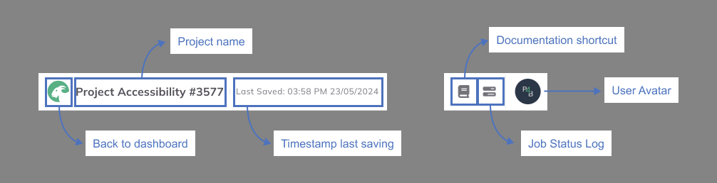
Upper Bar
The left side of the upper bar displays the name of your project and the date and time of the last saved change. On the right side, you will find a shortcut for this documentation, your job status log, and your user avatar.
Map
The following graphic explains the different elements of the map interface:
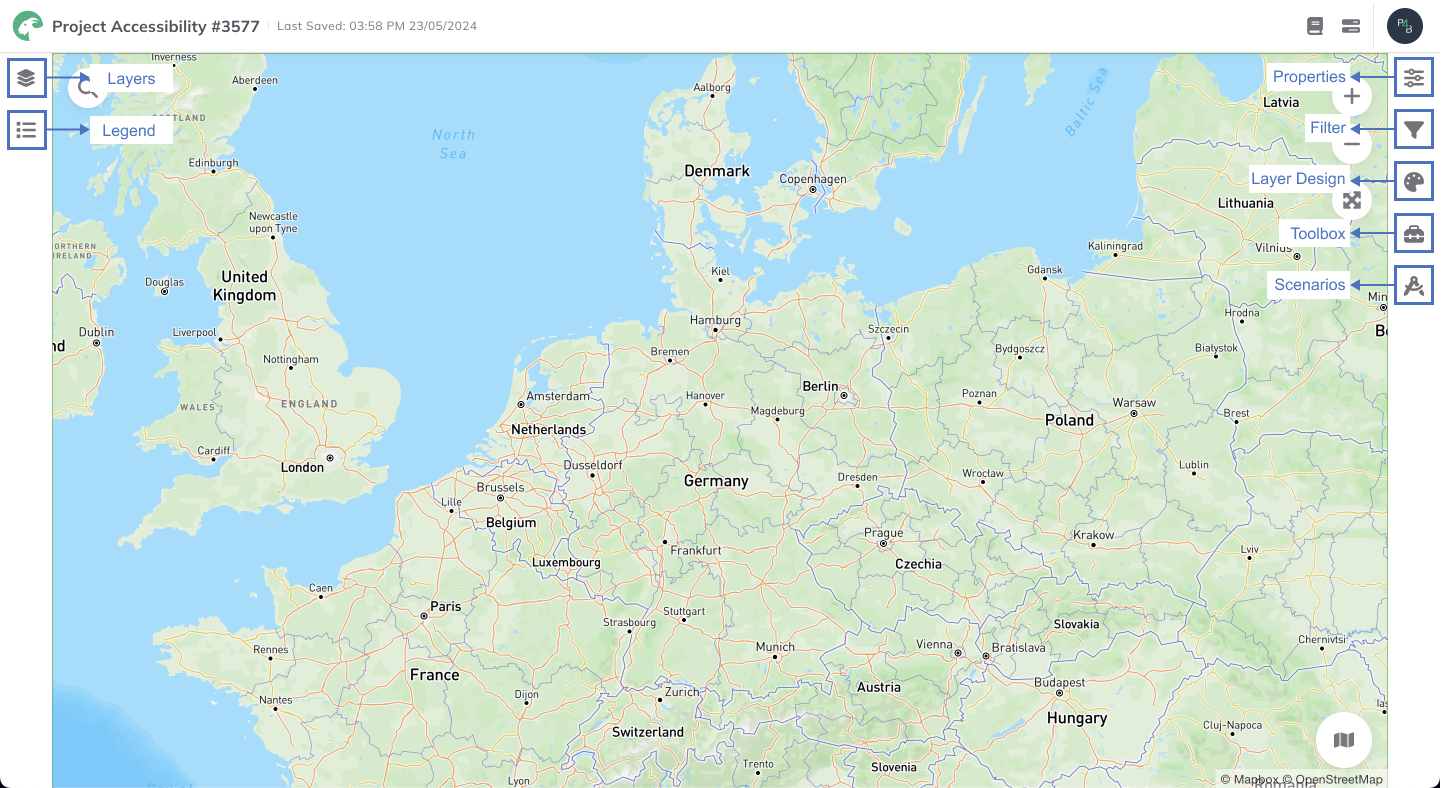
Navigation Bar

Layers: Within your GOAT project, add and manage your assets in the form of layers.
Legend: Visualize the legend of the active layer.
Charts: Coming soon.
Spatial Operations

Properties: View layer info, symbology and visibility settings for the selected layer.
Filter: Read more in Filter.
Layer Design: Read more in Layer Styling.
Toolbox: Read more in Toolbox.
Scenarios: Read more in Scenarios.
Map Navigation
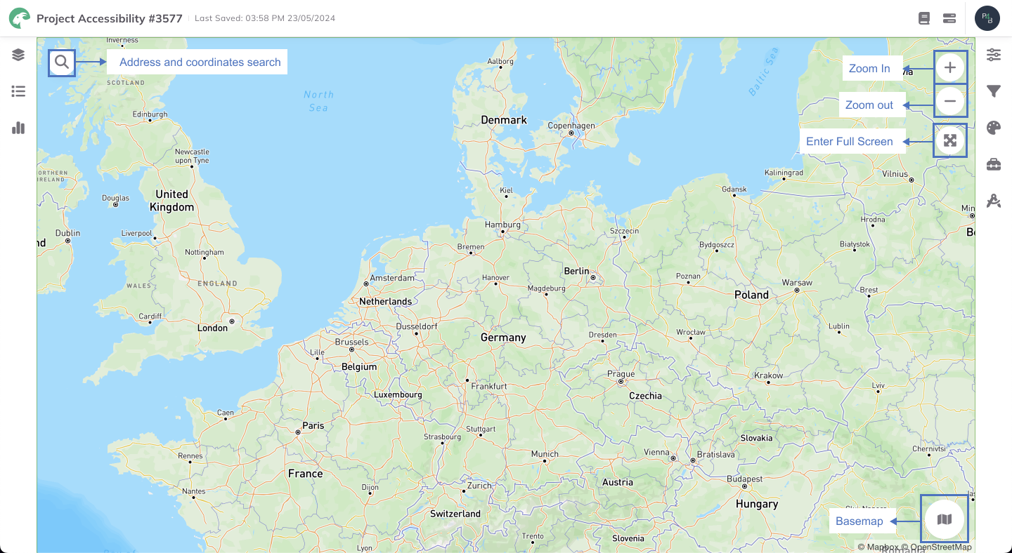
Buttons

Address and coordinates search
Zoom In
Zoom out
Basemap: Choose between basemap options such asHigh Fidelity,Satellite, and more.